The transportation industry is constantly evolving and improving as demonstrated by Civiltech’s recent Quentin Road (US 12 to IL 22) design for the Lake County Division of Transportation. At the forefront of the industry, Civiltech has already taken steps to incorporate the latest Three-Dimensional (3-D) technologies and software across all of our design stages, including construction. 3-D modeling is used to communicate design intent through visualization for analysis, animation, and simulations, which are valuable components to achieving project consensus.
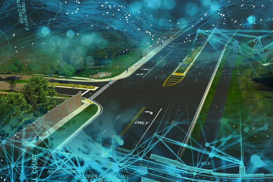
The Quentin Road project provided an opportunity for Civiltech, Lake County, the adjacent municipalities, and community to experience firsthand the advantages of some of our newly implemented software, modeling, and rendering technologies. Civiltech provided a 3-D engineered model and teamed with inVISION Studios to produce a high-quality, detailed video depicting the improved roadway and associated features such as traffic signals, signing, landscaping, culverts, retaining walls, and noise abatement walls. The 3-D engineered model was created during the design process along with information such as existing terrain elevations, sign and pavement marking locations, and aesthetic feature details to create realistic video renderings of the project corridor after completion. The videos included corridor flyovers and a driver’s perspective view through the corridor, complete with traffic, pedestrians, and bicyclists. These videos, along with still shots from the rendered model, were very helpful for public meetings, municipal coordination, and consensus building efforts. Parts of these renderings were also beneficial to the land acquisition process and helped convey to non-engineers how a project relates to and blends with each surrounding property. For example, in one instance involving a concerned homeowner, the 3-D model was used to create a rendered view of the roadway’s retaining wall and noise wall from the homeowner’s perspective, outside the right-of-way from the backyard. Aesthetic decisions were also much easier to evaluate for the determining noise abatement wall types and patterns.
Moving beyond design, building this 3-D engineered model is virtual construction – used to validate constructability and relay detailed design information to the construction team. A technology known as Automated Machine Guidance (AMG) is common in road and site construction and uses our 3-D engineered modeling as input for construction operations. In the near future, as some states have started to require, design engineers will submit a 3-D engineered model as part of the project bidding and advertisement phase. This model would include surfaces that represent existing terrain, a finished grade, subsurface utilities, and the underlying subgrade elevations necessary for computing earthwork and paving operations. Contractors use AMG software with grading equipment to produce the proposed surfaces in the field, and these technologies help reduce the amount of time and skilled operation required with traditional construction methods. In addition to direct construction cost savings, the increased design transparency improves the coordination and exchange of information across disciplines that can help eliminate a range of recurring disputes with contractors.
With the ever-increasing need to effectively relay more detailed information and clearly defined design intent, our use of this technology has proved to have wide-ranging advantages throughout our the planning, design, and land acquisition phases. Civiltech looks forward to assisting each of our clients and communities with visualizing aspects of a project’s design together in a complete, realistic, and relatable way, and thus helping overcome challenges along the way in such a rapidly advancing and changing industry.