One Project – Two Studies
Civiltech led a team in partnership with Ginkgo Planning & Design, CDM Smith and the Lakota Group to provide planning services to Chicago Metropolitan Agency on Planning and Will County for the Moving Will County project, which included a Truck Routing and Communities Study and a Land Use Strategy. The project is a planning-level study that includes a large, regional area: both study boundaries together include over 311,000 acres (486 square miles), 19 municipalities, and over 2,500 miles of roadway.
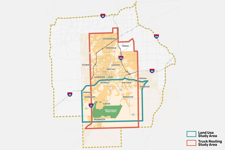
Click on image to view large.
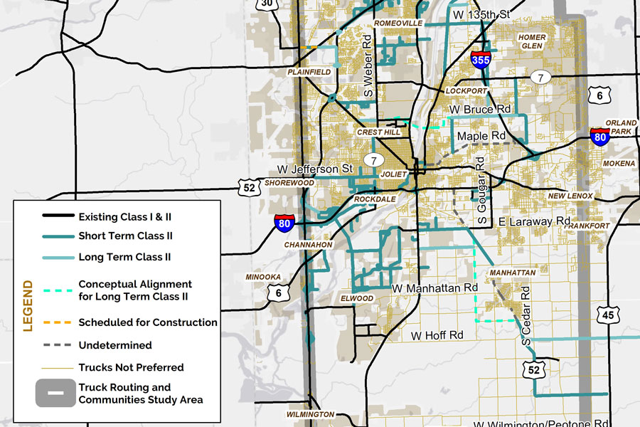
Click on image to view large.
Study Goals – Achieve Balance
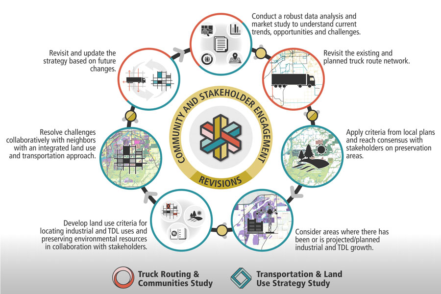
These studies were combined into one project due geographic overlap and the efficiencies that could be achieved by coordinating data collection and analysis, community outreach, and considering the interdependency of transportation and land use objectives. The joint goal of the studies is to achieve balance between truck traffic and routing, existing freight land use clusters and new development, agricultural business, natural and cultural resources, and residential neighborhoods and other sensitive areas. Both studies shared resources to develop appropriate and supportive recommendations to help Will County be competitive and resilient.
A Facilitated Open Planning Process
The team engaged in a facilitated, open planning process to develop a comprehensive truck route network and a land use strategy that can be used as a tool to guide future industrial and Transportation Distribution and Logistics (TDL) development. Community engagement with a goal of reaching consensus was at the heart of the planning process. The project began in Fall 2019 and concluded in Fall 2021.
Click on image to view large.
Benefits of the Truck Routing and Communities Study
- Truck routes can identify freight corridors best suited for travel by truck and ensure that trucks travel where local communities want them to travel, including away from schools, residential areas, and other sensitive land uses.
- Because of the greater highway design criteria for trucks, understanding designated truck routes will also give communities a better understanding of investment needs.
- Truck routes connect major truck trip generators, such as intermodal yards and major industrial facilities, to the arterial network and Interstate system. This provides clear and direct access for larger trucks that are critical to economic activity.
- They establish a framework consistent with recent changes in Illinois state law.
Scope of Services
- Transportation Planning
- Land Use Planning
- Freight Planning
- Environmental Resource Planning
- Complete Streets
- Community Engagement
- GIS
Benefits of the Land Use Strategy
- Concentrates Industrial and TDL uses around existing intermodals and already developed areas with similar uses.
- Supports continued investment in designated Truck Routes as recommended by the Truck
- Routing and Communities Plan Implementation Strategy.
- Avoids the costs of installation and maintenance of new infrastructure needed to access and serve undeveloped areas.
- Maintains opportunities for prosperity for all by providing Industrial and TDL development potential in all municipalities in the Study Area.
- Protects major natural resources and preservation areas, existing and planned bike trail corridors in the area, and the character and tourism potential.
- Prevents new Industrial and TDL uses from locating too close to existing residential areas, schools, places of worship, and civic and institutional uses.
- Allows flexibility in responding to changes in Zoning Ordinances and Comprehensive Plans as these are updated.
- Provides a tool that can be applied to other parts of Will County.
Similar Projects