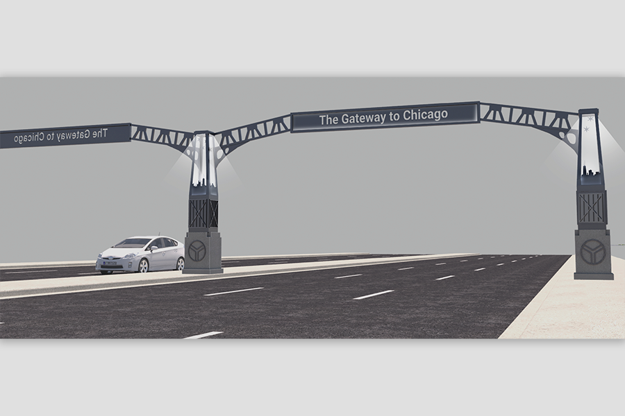
Creating a Gateway to Chicago
Civiltech, in partnership with the Lakota Group, Valerie Kretchmer Associates, and AP Monarch, was the lead consultant on a multi-disciplinary effort to investigate potential transportation and land use policy improvements to put forth redevelopment alternatives for the Cicero Avenue corridor from Interstate-55 to Marquette Road/67th Street. This regionally significant corridor serves as a gateway to the City of Chicago for visitors arriving at Midway Airport.
Click on image to view large.
Click on image to view large.
A Key Commercial Anchor
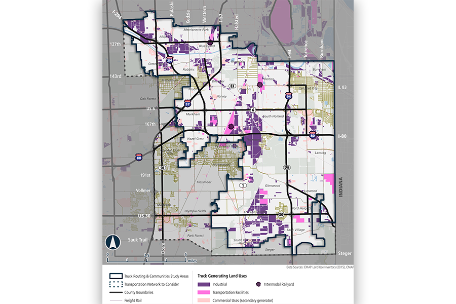
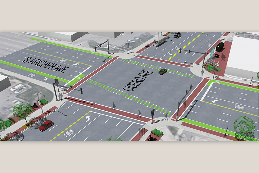
This corridor is a key commercial anchor for the Garfield Ridge, Clearing, Archer Heights, West Elsdon, and West Lawn City of Chicago neighborhoods. Also, it is one of the top ten truck routes in Cook County, facilitating freight movement in the region.
Developing a Unified Plan
To develop a unified vision for the corridor, the project team, City of Chicago’s Department of Transportation (CDOT) and Department of Planning and Development (DPD) partnered with a range of local stakeholder to:
- Address the needs of all users of the corridor.
- Evaluate street design and real estate market demand.
- Create an enduring plan for revitalization that improves vibrancy, livability, functionality, and safety in the community.
Click on image to view large.
Click on image to view large.
A Multi-Faceted Plan Built on Stakeholder Input
The corridor study kicked-off at the end of 2020, and with community stakeholder input, will conclude with the publication of a corridor plan that will include the following elements:
- A community engagement process to develop a shared vision for the corridor with local stakeholders.
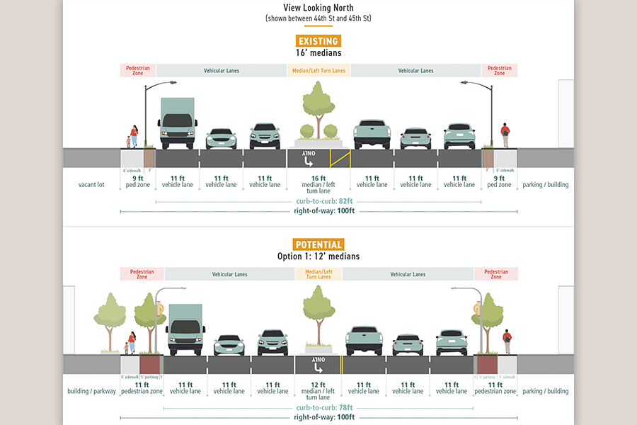
- The evaluation of existing transportation infrastructure, roadway safety, land uses, and real estate market.
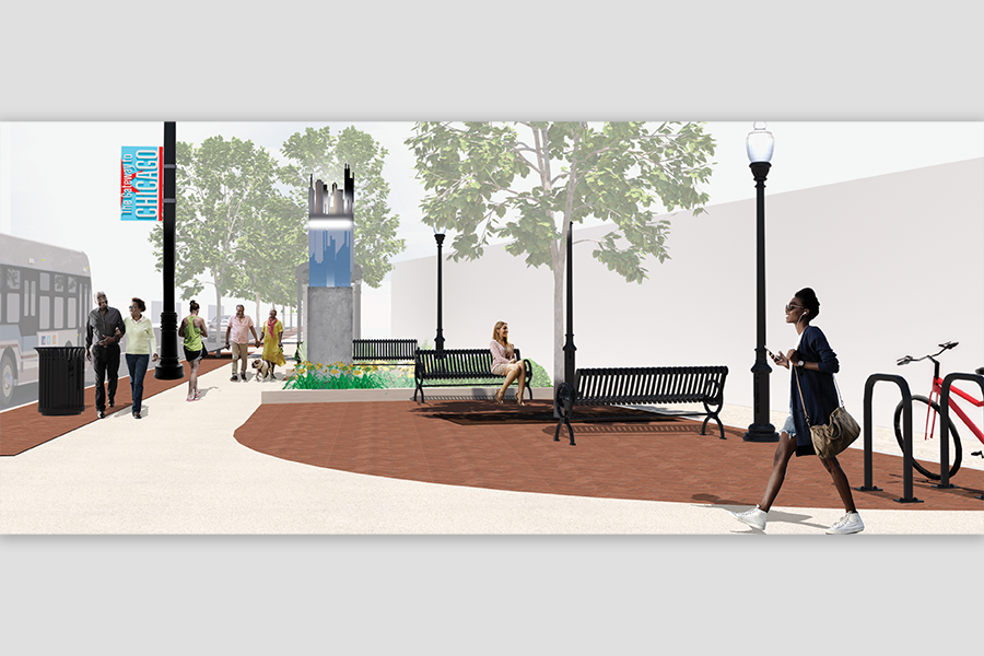
- The creation of site development scenarios, building design guidelines, and corridor design alternatives.
- A strategy for implementation of improvements, cost estimates and potential funding sources.
- The development of a Stakeholder Resource Reference Guide that includes tools and City resources to promote corridor revitalization.
The Project Incorporates the Following:
- Collaborative professional consultant team
- Alternatives Development
- Transportation and land use policy improvements
- Facilitating transportation, commercial, and freight considerations
- Developing a unified vision
- Building stakeholder consensus
- Publishing a Corridor Plan
- Creating a shared vision
- Implementation strategies
- Development of a Stakeholder Resource Reference Guide
Scope of Services
- Transportation Planning
- Lane Use Planning
- Market Study
- Community Engagement
- GIS
- Digital Rendering and CAD
Similar Projects